As I mentioned earlier about my embarrassment of the OlKalou name, anyone who knew the town back then in the 1970s would agree with me. Sort of. There was really not a town to speak of. It was a windblown center with few unsightly structures. There were residential houses with mud walls. The timber shops were really old, they looked like they were slanting, and the timber was well worn it had turned grey in color. The very old brick buildings were on the “fancy” side of town known as “kwa Uhindi” translation Place of Indians. I don’t know why it was called that because there was only one Indian in town. Bhachu. He owned a hardware store at the end of that line of shops on the “fancy” Indian side. His story later on.
There was raw sewage flowing in small streams in different parts of town. The market was dirty, with make shift structures for stalls. The barely there tarmac road branched off from the Nairobi Nyahururu highway at Agip Petrol Station, cut through town in front of the Kwa Uhindi line of shops and ended at the edge of town, slightly past the post office. I am not surprised there was no public transportation that entered OlKalou town back then.
When we started going to schools outside of OlKalou, when returning home for the holidays, we rode the Nyahururu bound buses from Nairobi. There were no Nissan matatus back then. Our buses were some old slow moving Fiat and Leyland model buses that took almost all day to travel from Nairobi to Nyahururu. We had a bus named Gitiyo and another one named Quick (Kwiki) Ironic right? Those are the buses we boarded in the morning at the famous Machakos Bus Terminal (Mashaku) in Nairobi, travelled all day as they made numerous stops along the way, dropping us off at the Nairobi Nyahururu highway at Agip Petrol Station as they chugged their way towards Nyahururu.
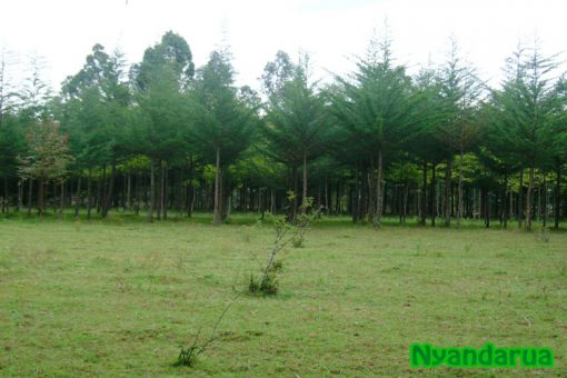
Along the way, the landscape started changing when we reached Naivasha. That was where we started to see vegetation that resembled OlKalou. The thorny umbrella shaped acacia trees, Mugaa in Kikuyu. Miririchua, I dont know the English name for it, but it is a trees with some whitish leaves that feels velvety to the touch. From the edge of Naivasha, branching off at Gilgil and proceeding towards Karunga, Ruriundu, Kabuteni, Chakareri and finally into OlKalou, the vegetation along that entire route screamed we were now in Ruguru, as Gikuyu people called Nyandarua.